
Digi-Surv™
Digi-Surv™ positions the borehole. Rig alignment before the first metre, collar survey, and magnetic or north seeking gyro trajectory survey during and after drilling, so that every dataset acquired in the hole can be placed correctly in 3D space.
What Digi-Surv™ answers
Digi-Surv™ is Digital Surveying's borehole positioning service: high-confidence geospatial positioning of the drill hole and of every dataset acquired in it, from collar coordinates and rig alignment to a depth-referenced 3D borehole path from magnetic or north seeking gyro survey.
Key answers
- Collar positionSurveyed collar coordinates in the project coordinate system, tied to the mine grid
- Rig alignmentAzimuth and inclination set accurately before drilling starts, on surface or underground, at any angle
- TrajectoryInclination and azimuth along the hole from electronic multishot (EMS) or north seeking gyro survey
- 3D borehole pathDepth-referenced northing, easting and elevation at every station, with dog-leg severity
- CorrectionDirectional wedging with QA monitoring when the hole must be steered back on target
Applications
- Exploration and grade control drilling
- Underground and surface mine planning
- Shafts, raise bores and tunnels
- Directional drilling and wedging programmes
- Positioning every Digi-Log™ dataset in space
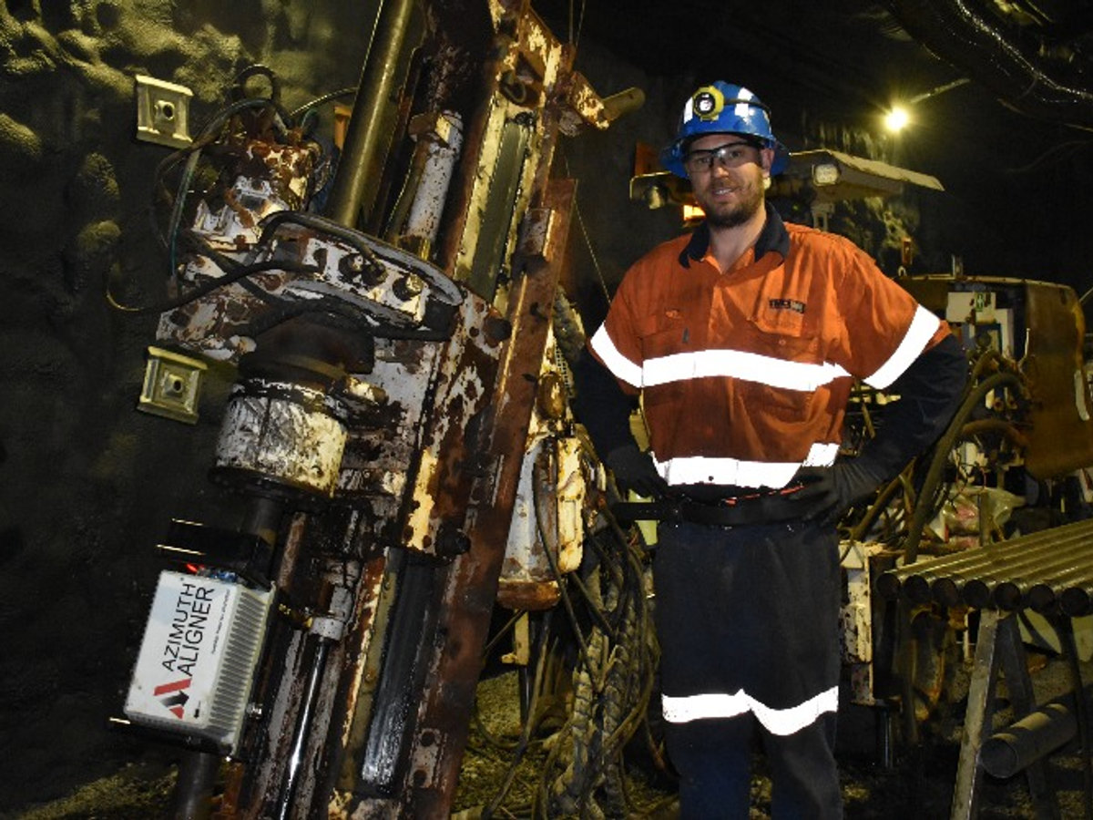
How a survey is run
A borehole is only as useful as its known position. Digi-Surv covers the hole from collar to toe: alignment before the first metre, survey during and after drilling, and correction when the hole drifts.
- Rig alignmentAccurate rig azimuth and inclination so the hole starts on target. Axis Navigator™, Hexagon Azi Aligner™ and Veracio TruProbe Align™ supported.
- EMSElectronic multishot survey using the geomagnetic field, single-shot or multi-shot, with wedge setting orientation. Needs a magnetically undisturbed environment and open hole below steel casing.
- GyroNorth seeking gyro survey: ultra-accurate, unaffected by magnetic interference, works inside casing and drill rods, referenced to geographic north. Single or multishot, output to Excel.
- WedgingDirectional wedging operations with quality assurance control monitoring.
Measured depth, inclination, azimuth corrected to the relevant north, magnetic field and dip, northing, easting and elevation, gravity tool face, dog-leg severity, latitude and longitude, at every station. That is the 3D borehole path for mine planning, geotechnical design and safety.
Survey tools can be run by our technicians or by trained drill crews with remote validation from our survey team. Results are exported from the tool on site, so a deviation is seen the same shift, not at the end of the hole.
Digi-Surv™ questions
Which is better for my hole, EMS or a north seeking gyro?
EMS is quick, economical and widely used, but it relies on the Earth's magnetic field, so it needs a magnetically undisturbed environment and open hole below steel casing. A north seeking gyro senses the Earth's rotation, references geographic north and is unaffected by magnetic ore, casing or drill rods. We recommend EMS for routine holes in quiet ground and gyro for casing, magnetic formations, and any hole where position drives a decision.
How do north seeking gyros orient themselves without a magnetic compass?
They sense the Earth's rotation. A north seeking gyro measures the horizontal component of the rotation vector, which always points to geographic north, so it works inside steel casing, drill rods and magnetic ore bodies where a compass cannot.
Can directional survey be conducted during drilling?
Yes. Surveying can be performed while drilling proceeds or after the hole is completed. Regardless of method (single-shot, multi-shot or gyro), a successful survey delivers measured depth, inclination, azimuth corrected to the relevant north, magnetic field and dip, northing, easting and elevation, gravity tool face, dog-leg severity and latitude and longitude at every station.
Does a survey expert need to be on site?
No. Modern survey tools are designed for drill crews to run after training, with data validated remotely by our survey team. For critical holes, shafts and wedging programmes we deploy our own technicians.
Can survey data be transmitted from the drill site?
Yes. Survey results are exported from the tool and can be uploaded from site to your data system or ours, so deviations are seen the same shift rather than at the end of the hole.
Why does borehole position matter for logging data?
Every log is recorded against measured depth along the hole. Without a trajectory, a structure picked at 312 m cannot be placed in the model. Digi-Surv gives every Digi-Log™ and Synthesis™ deliverable a verified 3D position and a common depth reference.
More in the FAQ & glossary.